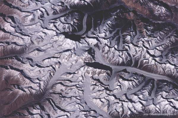
This satellite image, wherein one can see that at what point the east Karakoram summits are part of what is an enormous ice cap and from where the melting ice brings water to the Pakistani population whose existence depends on it, is of exceptional quality. Some peaks come out of this ice cap like those of Saser Kangri, even as high up as 7672m altitude. The average altitude of this region is the highest of the world. The merchants who traveled on the silk road went through the Saser La pass which is close. (not covered by the image) One can conceive how these unfriendly places were cursed by the merchants who had no desire to do any climbing.
 Nasa (http://eol.jsc.nasa.gov)
|
||||
|
See other maps about Nubra & Saser Kangri mountains :
To the same topics : |

|
Home - History - Geography - local life - Travelling - Forums - Gallery - Links - Index var pagename='Page_picture_sat_saser_kangri'; For more details, contact the Webmaster |